CHALET DE LA MADONE DE FENESTRE (FFCAM) (1903 m)

ALPES - Mercantour-Argentera
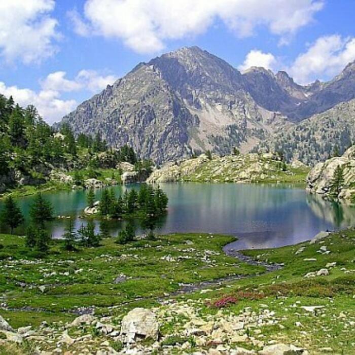
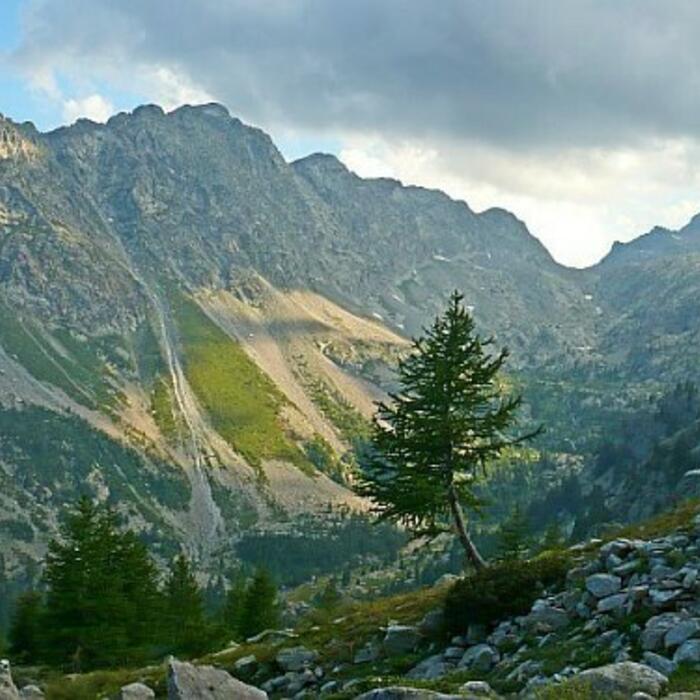
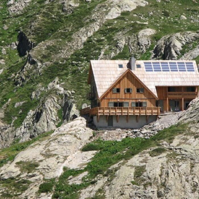
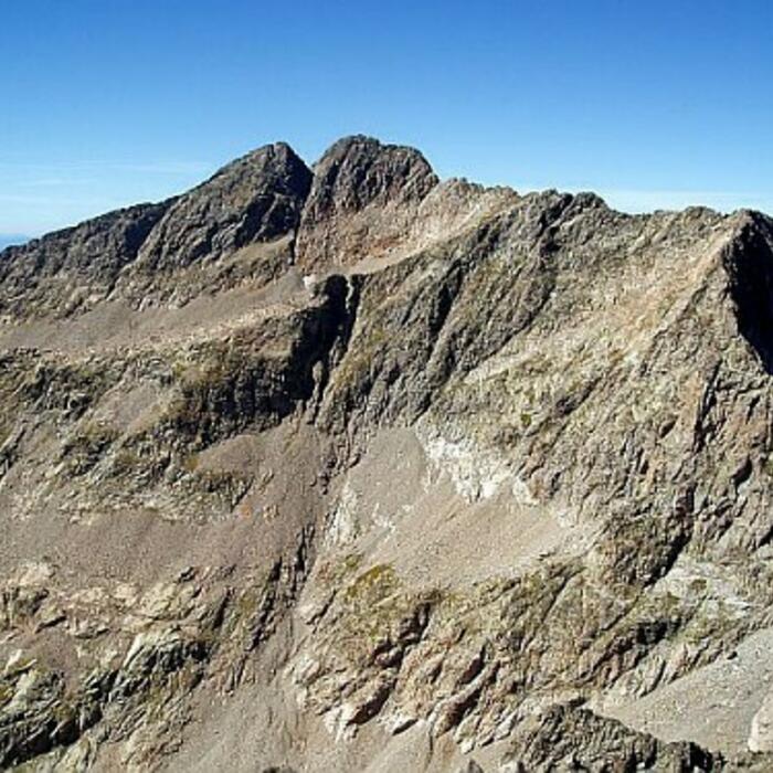
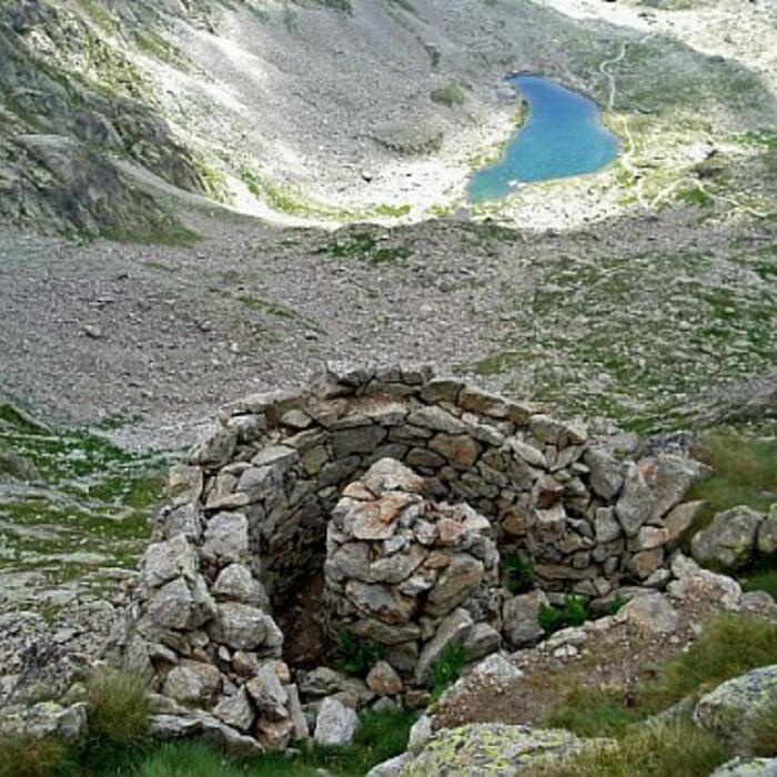
In the Mercantour National Park, the chalet of the Madonna de Fenestre is in the heart of a majestic alpine amphitheatre dominated by the local giant, the Gélas, the highest peak in the Alpes-Maritimes (3,143 m)

The chalet is the start of many mountaineering or climbing races as well as family hikes (window lake, drop of the five lakes ...). The guards offer accommodation with a common restaurant in the evening and a menu at noon for a gourmet break or a small snack.

06450 SAINT MARTIN VESUBIE

Phone: 06 09 17 89 58
Email
Website

Patrick MIRAILLET

Patrick MIRAILLET

GPS (UTM WGS84):32T 368431 4883823
GPS address decimals:44.095773, 7.356322
Map:3741 OT

:Central area of the Mercantour Park

Opening

From June 1st to September 30th. Booking only online.
Other periods: babysitting on weekends and school holidays only by reservation by phone at 06 09 17 89 58
Foreign languages spoken: English - Italian

Nombre de couchages:62
General comfort:Paid hot shower
Nombre de couchages:22
General comfort:Stove, blankets, dishes, lighting.

Access

Summer car parks at the Sanctuary of the Madonna of Fenestre - Accessible by RandoBus: see the tab "Tourism Info"
Winter car parks on the sanctuary road (cut)

Voir sur la carte

Activities

Alpinisme
Ski de randonnée nordique
Raquettes
Ski de randonnée
Randonnée montagne
Ski alpinisme

MOUNTAINEERING : Ridges of St Robert - Caire de la Madone - Gelas - Mont Ponset - Mont Neiglier- Pointe André
HIKE : Connection to refuges Nice, de la Cougourde - Soria (CAI) - GR 52
SKI : balcony of Gélas - tour of Gélas - Cime W de Fenestre - Cayre Cabret
+ on sud.alpes-refuges.fr

Gestionnaire

CLUB ALPIN FRANCAIS NICE MERCANTOUR
14 AV MIRABEAU
NICE
04 93 62 59 99
cafnice@ffcam.fr
http://cafnice.ffcam.fr

Météo

Tick and untick to personalise your map. You will only see elements linked 'at the start' on your map (See path X)

Loading
Ski-ing conditions :
Orientation :

Access

Road access Public transport
  • GPS (UTM WGS 84): 32T 368376 4883783
  • Decimal GPS ccordinates: 44.095401 N - 7.355645 E
1903 m

Without snow
:
0.05 km
: 0 h 02 mn
:From the parking lot, head towards the sanctuary. The mountain hut overlooks it on the left.
: 0 h 02 mn
:From the hut, go down to the square of the sanctuary and reach the road.
Winter road access
  • GPS (UTM WGS 84): 32T 361428 4882347
  • Decimal GPS ccordinates: 44.081200 N - 7.269260 E
1140 m

With snow
:
7.5 km
:
765 m
: 3 h 30 mn
:Depending on the snow conditions, especially in spring, the road may be cut higher than the stele. So you can more or less shorten your hike.

Description:
Go up the road of la Madone to reach the plateau of Devensé.
At the level of the lower bridge of Devensé (beacon.350), leave the road to take left the old trail of Madone which crosses the big avalanche corridor of the Pounche, and joins a recongnisable hairpin bend of the road. WARNING: in case of heavy snowfall, do not cross this corridor, instead use the road entirely.
At beacon 355, turn left on the old road and climb diagonally into the wooded area overlooking the valley of Fenestre to reach the sanctuary plateau after crossing a narrow avalanche slope (beacon. 356).
The mountain hut of la Madone de Fenestre is located upstream of the esplanade.
: 0 h 00 mn
:Depending on the snow conditions, especially in spring, the road may be cut higher than the stele. So you can more or less shorten your hike.

Description :
Go down the valley taking first the old way of la Madone, then the main road.
WARNING: in case of heavy snowfall, use the road entirely.

Ref.Madone de Fenestre-Balcon du Gelas A/R 1j

Ref.Madone de Fenestre-Cime de l'Agnellière A/R 1j

Ref.Madone de Fenestre-Cime du Pisset A/R 1j

Ref.Madone de Fenestre-Cime Ouest de Fenestre Boucle 1j

Ref.Madone de Fenestre-Col de Fenestre Boucle 1j

Ref.Madone de Fenestre-Crête de Férisson Boucle 1j

Ref.Madone de Fenestre-Lacs de Prals Boucle 1j

Ref.Madone de Fenestre-Mont Ponset A/R 1j