Ref.Valmasque-Mont Sainte Marie A/R 1j

ALPES - Mercantour-Argentera
A pied

1 jour

12 km

600 m

600 m

Difficulté 3

3841OT

à traduire (en)

2740 m

Durée de l'étape la plus longue
05:30:00

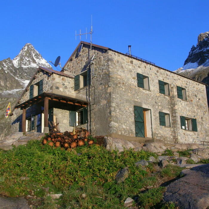
A beautiful summit overlooking the lakes and the mountain hut of Valmasque

Round trip over one day: departure and return to the mountain hut of Valmasque

Tick and untick to personalise your map. You will only see elements linked 'at the start' on your map (See path X)

Loading
Ski-ing conditions :
Orientation :

Downloads
Stages A pied
  • Start:REFUGE DE LA VALMASQUE (FFCAM)
  • End:REFUGE DE LA VALMASQUE (FFCAM)
  • Duration:05h30
  • Dénivelé positif en été:600 m
  • Dénivelé négatif en été:600 m
  • Distance en été:12.1 km
  • Remarks:
    WARNING: Route without signposts. Requires map and compass, or GPS.

    Description:
    From the mountain hut of Valmasque (2233 m), cross the spillway of lake Vert, to the left of the dam. At beacon 98a, take the left pathway to get to the beacon 98 (2205 m).
    From there, stop the descent and follow the pathway to the right to go up to the beacon 97 (2294 m). Stay on the yellow marking to go down to the left towards the lake Noir, which you will go along the right orographic bank. Then the lake Basto bank.
    At beacon 96 (2366 m), turn left on a tiny pathway on a grassy-pebbly stretch. Once you arrive at the bottom of a steep wall, the slope will suddenly rise and the tiny path go up by small zigzags until reaching the mountain pass of Fontanalbe (Baisse de Fontanalbe, 2574 m-beacon 397).
    From there, by a tiny pathway with cairns to the left, turn Northeast towards the summit Bicknell (2641 m). Then go along the Rochers Sainte-Marie in a Northeast direction to reach the summit of mount Sainte Marie (2740 m).
    The return to the mountain hut of Valmasque (Refuge de Valmasque) occurs by the reverse route.

<< < > >>

You can book your accommodation if their availabilities show. If not, there is a link to websites where you can make your reservation.