Cascade, lacs et Merveilles Boucle 3 jrs

ALPES - Mercantour-Argentera
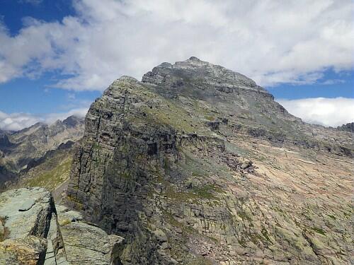
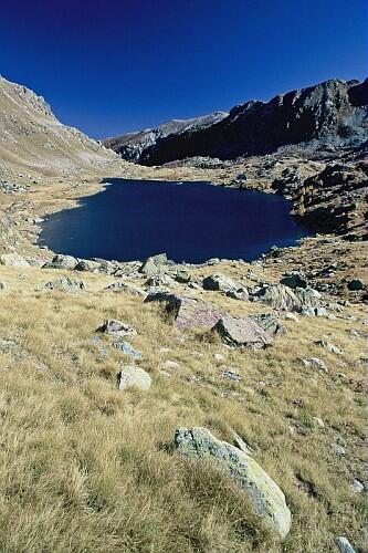
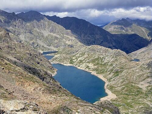
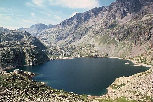
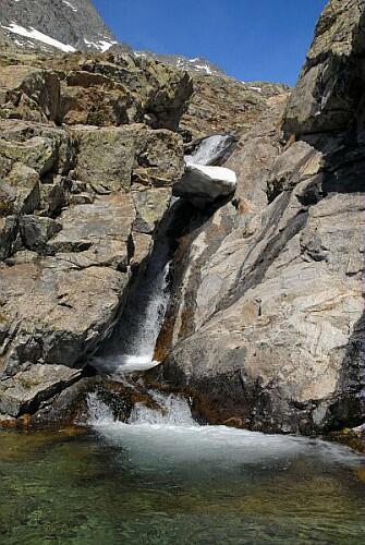
A pied

3 jours

20 km

1500 m

1500 m

Difficulté 3

3741OT

5h00

à traduire (en)

2650 m

Durée de l'étape la plus longue
05:00:00

Tertiary rocks polished by glaciers, generous cascades, high lakes, and engravings of the Valley of Merveilles will cause the respect and the admiration of each one

Circuit over 3 days: departure and return to the parking of the Countet

CHECK THE SNOW CONDITIONS OF EACH STAGE OF YOUR ROUTE A FEW DAYS. HUT MANAGERS WILL PROVIDE YOU WITH INFORMATION.

Tick and untick to personalise your map. You will only see elements linked 'at the start' on your map (See path X)

Loading
Ski-ing conditions :
Orientation :

Downloads
Stages A pied
  • Start:Nice : Pont du Countet
  • End:REFUGE DE NICE (FFCAM)
  • Duration:02h00
  • Dénivelé positif en été:690 m
  • Distance en été:5.3 km
  • Difficulty:à traduire (en)
  • Remarks:
    The parking lot of the Countet (1690 m), the path signposted orographiique right bank of the Gordolasque until the tag 413.
    Cross the torrent right and borrow in front the path which rises up to the tag of 414.
    From there, ignore Lake Autier right trail to ascend the trail left in the steep climb of the wall of the Italians. Reached on a wide Ledge (2010 m), on the other Bank of the stream and continue rising following carefully the cairns and yellow markings.
    Reached at 416 beacon, continue by following the red and white GR signs that goes around the Lake to the right of the crazy before reaching the shelter of Nice (2232 m).
  • Start:REFUGE DE NICE (FFCAM)
  • End:REFUGE DES MERVEILLES (FFCAM)
  • Duration:05h15
  • Dénivelé positif en été:550 m
  • Dénivelé négatif en été:660 m
  • Distance en été:9.2 km
  • Remarks:
    Through Baisse du Basto

    WARNING: Please note that this route includes progression on scree.

    Hiking on a site classified historic monument that confers regulated usage

    Description:
    From the mountain hut of Nice (2220 m-beacon 417), follow the red and white markings of the GR 52 which goes up a few meters to emerge on a grassy flat land before crossing the stream coming from the valley of La Fous (beacon 418).
    Then climb up the spillway of lake Niré and go along the series of lakes. From the last one, the slope will be accentuated to climb a zone of blocks and scree before reaching, after a last steep slope, the mountain pass of Basto (Baisse du Basto 2650 m-beacon 401).
    From there, go down on the other side. The GR begins in zigzags in a steep slope, then becomes more comfortable while overlooking the wide lake of Basto.
    At the beacon 95, begin the rise towards the mountain pass of Valmasque (Baisse de Valmasque).
    From there (2549 m-beacon 94), enjoy the view overlooking the valley of the Merveilles and its many lakes and descend by a winding path to pass between two small lakes, then cross the valley of Merveilles and continue on the left bank. Bypass the lake of Merveilles on its Eastern shore. Near its spillway is the famous rock engraving of the "Chief of the Tribe" that one sees from the GR. Take the time to consult the explanatory panels that line the trail.
    Ignore the path on the right that leads to "Pas de l'Arpette" and join soon the beacon 93 before the last descent on the mountain hut of Merveilles nearby (Refuge des Merveilles-2115 m).
  • Start:REFUGE DES MERVEILLES (FFCAM)
  • End:Nice : Pont du Countet
  • Duration:04h00
  • Dénivelé positif en été:380 m
  • Dénivelé négatif en été:820 m
  • Distance en été:6.3 km
  • Remarks:
    Through Pas de l'Arpette

    Hiking on a site classified historic monument that confers regulated usage.

    Description :
    From the mountain hut of Merveilles (2111 m), join the GR52 (b.92). Follow on the right the red and white marking which rises by two or three laces to the beacon 93.
    From there, leave the GR and follow the path leading up to the Pas de l'Arpette (2511 m-b.402).
    Then descend to the other slope by the path of the steep Empuonrame valley. The slope ends up softening and the trail then continues overlooking the Gordolasque until the Countet bridge (1690 m-b.412).
    Cross it to reach the parking lot (b.411).

<< < > >>

You can book your accommodation if their availabilities show. If not, there is a link to websites where you can make your reservation.