Lacs et curiosités de la Haute Tinée A/R 5 jrs

ALPES - Mercantour-Argentera
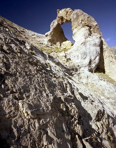
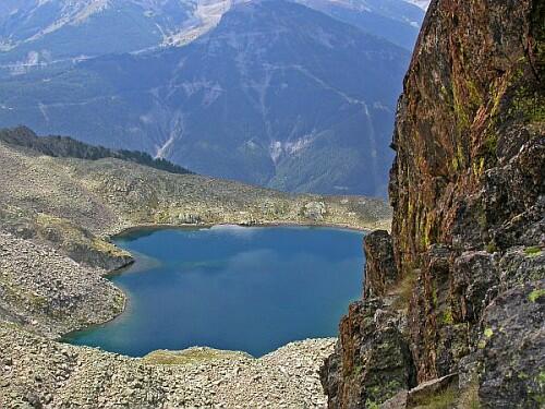
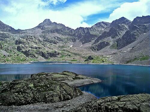
A pied

5 jours

48 km

2600 m

2600 m

Difficulté 3

3639OT

à traduire (en)

2995 m

Durée de l'étape la plus longue
05:30:00

A circuit to admire some of the most beautiful lakes of Mercantour and the spectacular Aiguilles de Tortisse.

5-day round trip: departure and return to Le Pra

CHECK THE SNOW CONDITIONS OF EACH STAGE OF YOUR ROUTE A FEW DAYS BEFORE. HUT MANAGERS WILL PROVIDE YOU WITH INFORMATION. 

Tick and untick to personalise your map. You will only see elements linked 'at the start' on your map (See path X)

Loading
Ski-ing conditions :
Orientation :

Downloads
Stages A pied
  • Start:Vens : Le Pra
  • End:REFUGE DES LACS DE VENS (FFCAM)
  • Duration:03h30
  • Dénivelé positif en été:650 m
  • Distance en été:7 km
  • Difficulty:à traduire (en)
  • Remarks:
    From the car park of Le Pra (1650 m), take the pathway which goes up in zigzags in fragile terrain till the plateau of Morgon (beacon.33).
    From there, the slope subsides to reach the forest house of Tortisse (Maison Forestière de Tortisse, 2252 m-beacon.34).
    Do not take the pathway on the left which leads to the "Col du Fer" but go up on the pathway to the right until the "Crête de la Côte" (2422 m). Continue the traverse to beacon 23.
    From there, do not take the right path that leads to the lakes, but continue on the left path that overlooks the upper lake of Vens.
    Once reached the beacon 24, go down on your right towards the mountain hut of Vens (Refuge de Vens, 2366 m-beacon 25).
  • Start:REFUGE DES LACS DE VENS (FFCAM)
  • End:REFUGE DE RABUONS (FFCAM)
  • Duration:05h30
  • Dénivelé positif en été:560 m
  • Dénivelé négatif en été:430 m
  • Distance en été:12.8 km
  • Remarks:
    The path "Chemin de l'Energie" is cut off from the beacon 111 to the beacon 110. A signposted deviation is set up but the route is partly off-track : Note that you must have a compass and a map or a GPS

    THIS INFORMATION CONCERNS HIKING WITHOUT SNOW.

    Description:
    From the mountain hut of Vens (2378 m), take a tiny pathway Northwest that will cross the stream of Vens and join the pathway that runs along the upper lake by its right orographic bank. At the end of the lake, ignore a path that rises to the right, but continue on the main path till the beacon 27.
    There, ignore the pathway that rises to the right, but continue along the lake. At the beacon 26, the pathway will take a Southern orientation, pass between the last 2 lakes and start its ascent to the lake of Babarottes. After going along it, the pathway goes in a few zigzags to reach the ridge of the Babarottes (2506 m), then goes down zigzags until the path "Chemin de l'Energie" (beacon 113).
    Then take the left, ignoring the path that descends into the valley of Clai, but go on the large path for a panoramic traverse on the mountainside.
    At the beacon 112, ignore the pathway that descends to the right towards Saint-Etienne-de-Tinée, but continue straight ahead.
    Once reached the beacon 111, leave the "Chemin de l'Energie" and follow the markings of the deviation which leads, by a ascent Southeast, to the lake of Fer (Lac de Fer-2541 m)).
    From there, follow the Western shore of the lake and turn South and then Southwest to return to the "Chemin de l'Energie" above the lake Petrus (2380 m-beacon 110).
    Take it left and stay on it, ignoring the pathway that descends towards Saint-Etienne-de-Tinée. Similarly to beacons 103 and 104.
    Go past the EDF house and climb up to the banks of the lake of Rabuons (beacon 105) and to the mountain hut that overlooks it (Refuge de Rabuons-2509 m).
  • Start:REFUGE DE RABUONS (FFCAM)
  • End:REFUGE DE RABUONS (FFCAM)
  • Duration:05h30
  • Dénivelé positif en été:470 m
  • Dénivelé négatif en été:470 m
  • Distance en été:5.5 km
  • Remarks:
    GRAND CIMON hiking

    WARNING: Route without signposts. Requires map and compass, or GPS.

    Description:
    From the mountain hut of Rabuons (2523 m), head North to the beacon 105 and take on the right the signposted pathway along the West bank of the Rabuons lake.
    Shortly after the rain gauge (2530 m-beacon 106), climb North to reach the Chauffour lake, then Cimon lake (2661 m). Leave the signposted pathway and turn East, leaving the Cimon lake on your left. Follow for a while its right bank, then turn Northeast to take a pathway with cairns that goes up to the mountain pass of the Trois Pointes (2826 m).
    From there, follow Southeast the border ridge, while remaining on the French mountain side, to easily reach the summit of the Grand Cimon (2995 m).
    The return to the mountain hut of Rabuons occurs via the reverse route.
  • Start:REFUGE DE RABUONS (FFCAM)
  • End:REFUGE DES LACS DE VENS (FFCAM)
  • Duration:05h30
  • Dénivelé positif en été:430 m
  • Dénivelé négatif en été:560 m
  • Distance en été:12.8 km
  • Remarks:
    The path "Chemin de l'Energie" is cut off from the beacon 110 to the beacon 111. A signposted deviation is set up but the route is partly off-track : Note that you must have a compass and a map or a GPS
    THIS INFORMATION CONCERNS HIKING WITHOUT SNOW.

    Description:
    From the mountain hut of Rabuons (2509 m), go to the banks of the lake (beacon 105) and go down West on the pathway. You quickly reach the panoramic path "Chemin de l'Energie" for a traverse on the mountainside.
    Go past the EDF house and ignore at beacons 104 and 103 the pathways that descend to the left towards Saint-Etienne-de-Tinée, but continue on the broad path.
    On reaching the lake Petrus (2380 m-beacon 110), leave the "Chemin de l'Energie" and follow the marking of the deviation which leads, through a Northeast and then North climb, to the lake of Fer (Lac de Fer-2541 m)). Follow the Western bank of the lake and descend Northwest to "Plan du Tenibre", where you will recover the "Chemin de l'Energie" (beacon 111).
    Continue West on this broad past, ignoring at the beacon 112 the pathway that descends to the left towards Saint-Etienne-de-Tinée. Similarly to the beacon 113.
    The pathway then climbs up to the ridge of the Babarottes (2506 m), then descends to the lake of Babarottes, along it, and continues to descend till the lakes of Vens.
    After passing between the first 2 lakes, the path will take a Northeast orientation (beacon 26) and along the right orographic bank of the lakes.
    At the beacon 27, ignore the path that rises to the left, but continue along the lake and thus reach the upper lake of Vens. After going along it, take East the tiny pathway that will cross the stream of Vens before arriving at the mountain hut (Refuge de Vens-2378 m).
  • Start:REFUGE DES LACS DE VENS (FFCAM)
  • End:Vens : Le Pra
  • Duration:04h30
  • Dénivelé positif en été:340 m
  • Dénivelé négatif en été:1020 m
  • Distance en été:10 km
  • Remarks:
    By lakes Morgon circuit

    WARNING: Route without signposts. Requires map and compass, or GPS

    Description:
    From the mountain hut of Vens (2380 m), go to beacon 25 and follow the signposted pathway to the left. Turn right at beacon 24 and climb up into wide zigzags in a landscape with bold architecture till the mountain pass of Tortisse (Collet de Tortisse, 2591 m-beacon 35a).
    Continue North to the mountain pass of Fer (Col de Fer, 2584 m- beacon 35).
    From there, leave the signposts and take a tiny pathway with cairns which goes up Northwest towards the mountain pass of Morgon (2714 m).
    Then descend Northwest on the left side of the broad valley of Gorgeon Long. You will pass between a succession of small lakes before reaching the upper lake of the Morgon lakes. Continue Southwest to reach the larger lake Morgon. Follow its right bank to reach, around 2427m, a tiny pathway that is oriented Northwest to emerge onto the valley of Cabane.
    Continue left in this valley and off track until you find the pathway of Salso Moreno.
    Go left on the pathway (South), pass farther the ‘Pas de la Croix Blanche' (2081 m), and go down quickly in the valley until reaching the D64 road (beacon 42) over the hamlet of Pra and the car park (1700 m).
    Take the road on the left to reach the parking lot.

<< < > >>

You can book your accommodation if their availabilities show. If not, there is a link to websites where you can make your reservation.